blah blah blah
Bayle Mountain
Length: 3.0 miles out-and-backDifficulty (click for info): Easy
Elevation Gain: 910 feet (+60 feet on return)
Rating (click for info): 7/10
Elevation: 1844'
Prominence: 156'
Driving Directions:
Trailhead and parking area are on Marble Road in Ossipee, NH. From Rt. 16/25, 3.2 miles north of the southern junction of 25 and 16 and 2.5 miles south of the northern junction, turn southwest onto Pine Hill Road. Use caution, as the roads you will take to the trailhead are dirt and have narrow, winding sections. Drive 3.4 miles, then bear right onto Connor Pond Road as Ossipee Mountain Road comes in from the left. Continue 0.6 miles, passing a boat launch on Connor Pond, and bear right just before a wooden bridge onto Marble Road. Continue 0.7 miles to a point just before another bridge, and park at a designated hiker pull-off on the right. This is a privately owned and maintained parking area, and the owner requires that visitors please park diagonally (except in winter) and do not park outside of the lot. Part of the trail is also on private land and is subject to closure if abused. Click here for a Google map.
About the Hike:
Bayle Mountain is a small but very rocky summit in the northern section of the Ossipee Range. A spur of trailless Bald Mountain, it rises to the northwest of Connor Pond. The mountain, along with the hiking trail, was burnt over in a 2015 forest fire, which exposed more ledge around the summit. The area has recovered well, but some remnants of the fire can still be found. There is one way to the summit, the very scenic Bayle Mountain Trail. The trail begins on a snowmobile trail and passes through boulder fields and ledges on its way to the summit. To reach the trailhead, you will have to drive into the somewhat remote valley in the center of the Ossipee Range. The benefit of this remote drive is that when you climb to the summit, you are already in the inner reaches of the majestic ring of the Ossipee Range and will have an incredible and unique view of mountain slopes rarely seen up close.
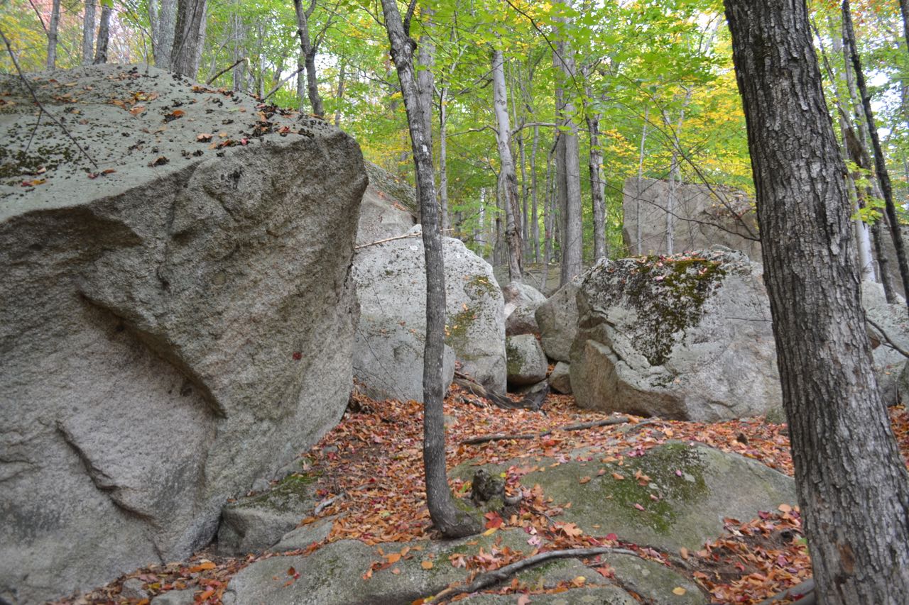
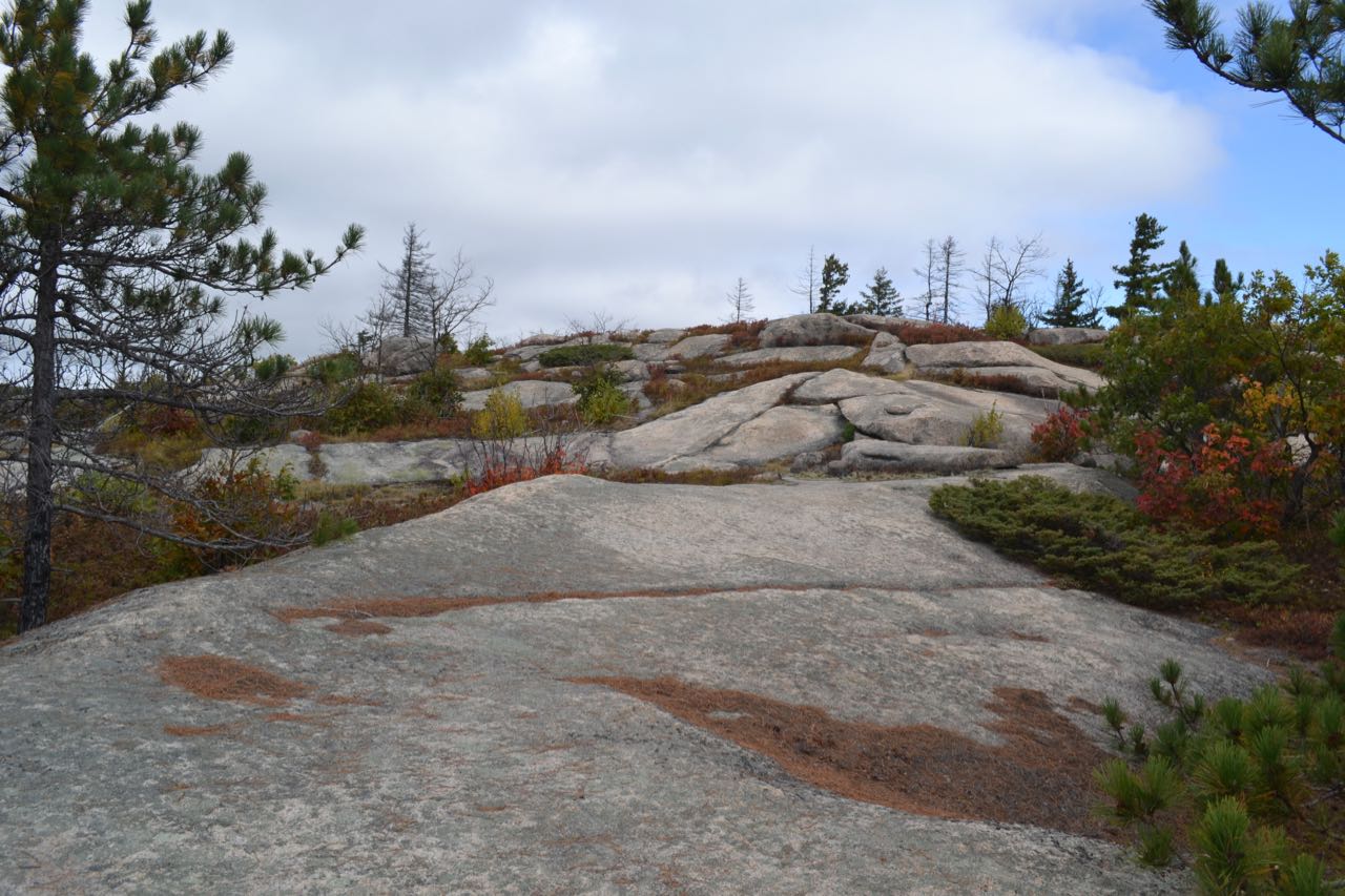
Start your hike at the side of the scenic Lovell River. Walk 150 feet further up the road from the parking area and turn right immediately before the bridge into a grassy clearing. Start walking down a snowmobile trail/woods road with an orange gate. Several signs prohibit wheeled vehicles and parking in front of the gate. The grassy road climbs slightly, and in 0.1 miles bears right through a small clearing. It runs mostly flat for 0.3 miles, then bears left at a fork where another road leads down to a gravel pit, then bears right at another fork shortly after. Continue along the road as it leads gradually up and down for another 0.3 miles. On a steeper uphill section, turn left onto a footpath marked with a cairn and orange paint. The trail, now well-marked with red blazes, leads up across a sharp sidehill for 0.15 miles, then swings uphill and ascends through an area of mammoth boulders. You wind between the huge rocks for a while as the trail steepens and climbs 0.2 miles up to the first ledges. The trail passes through beautiful forest glades as it climbs up around steep ledges. Burnt tree stumps are evidence of the forest fire. The trail continues steeply up, alternating through forest areas and rock, for 0.2 miles until it comes out onto the barren, ledgy dome of the summit. Enjoy a scenic walk for 0.1 miles over the ledges through low, brushy areas as views rise behind you.
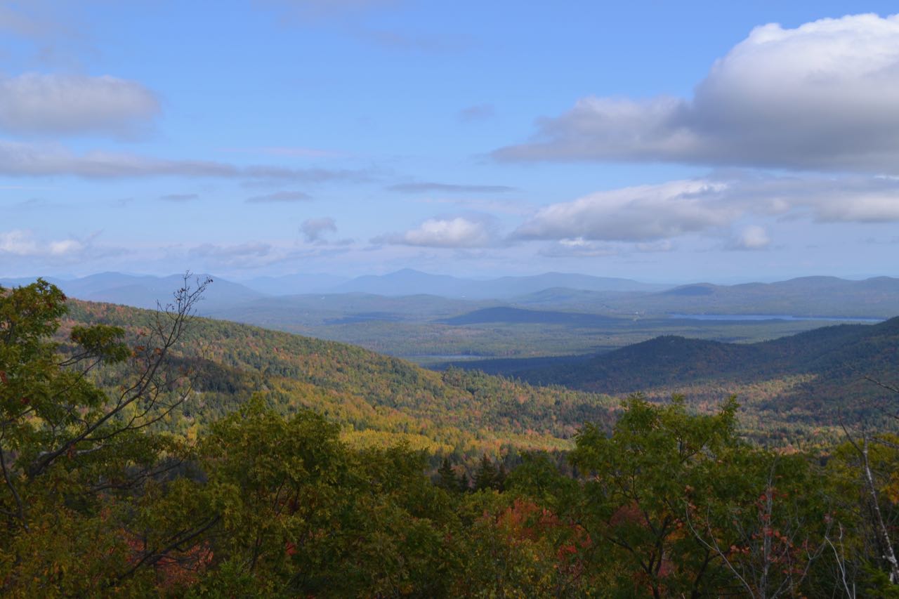
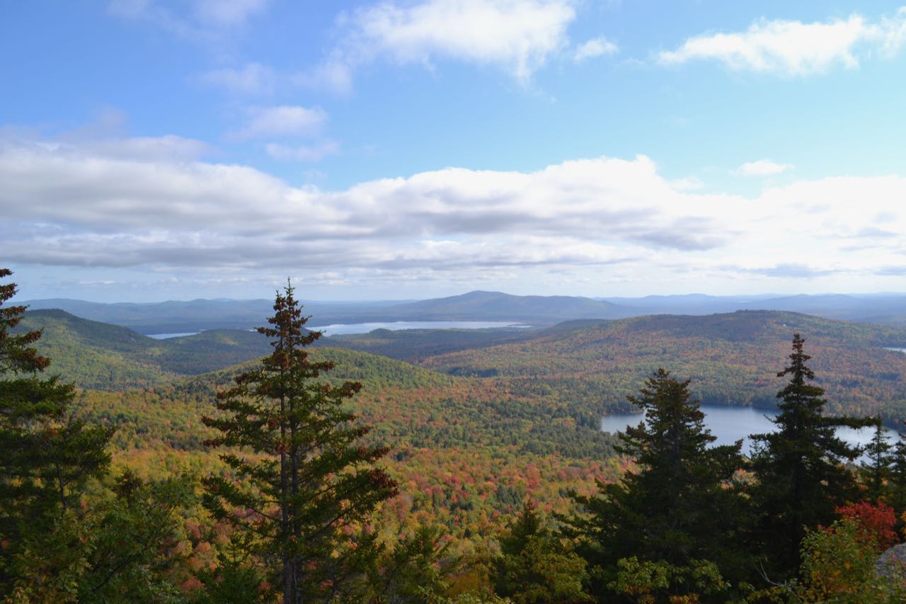
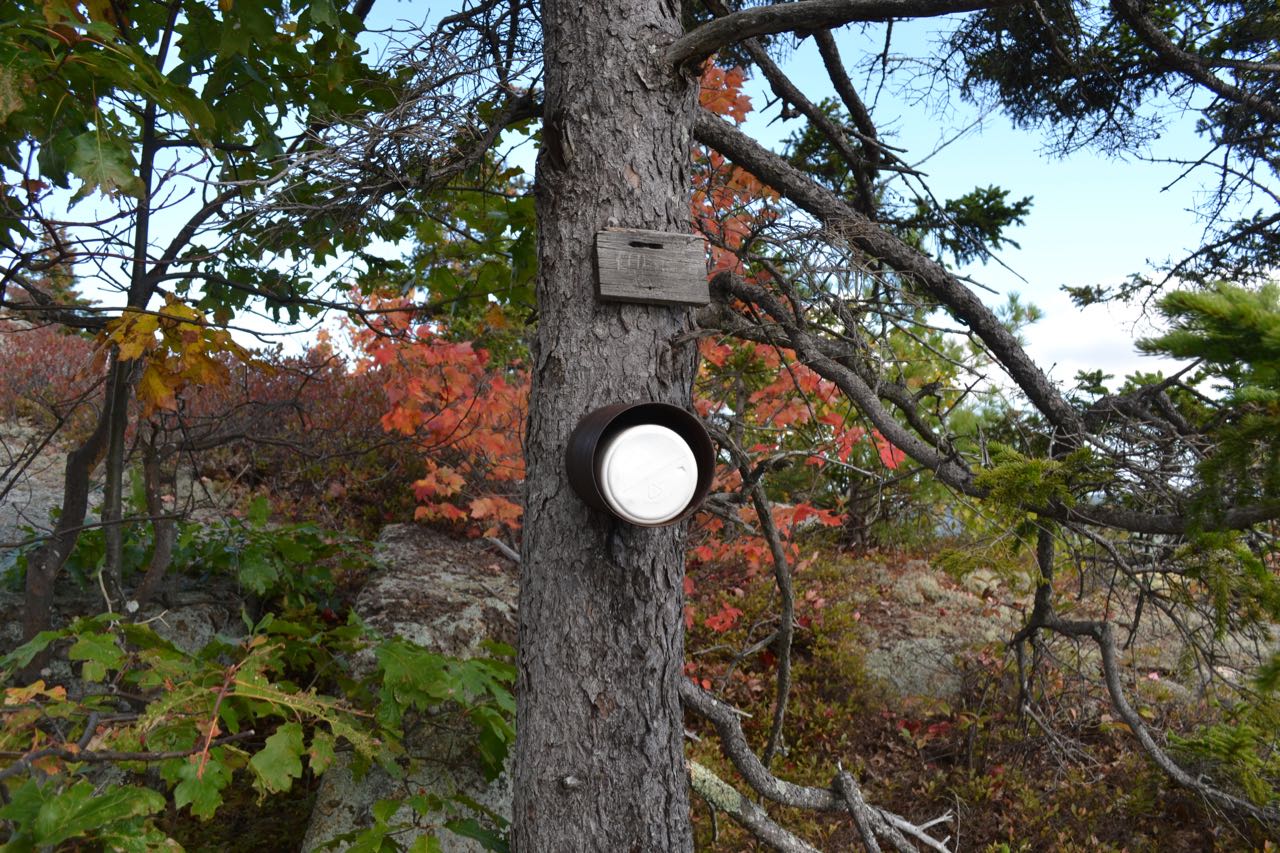
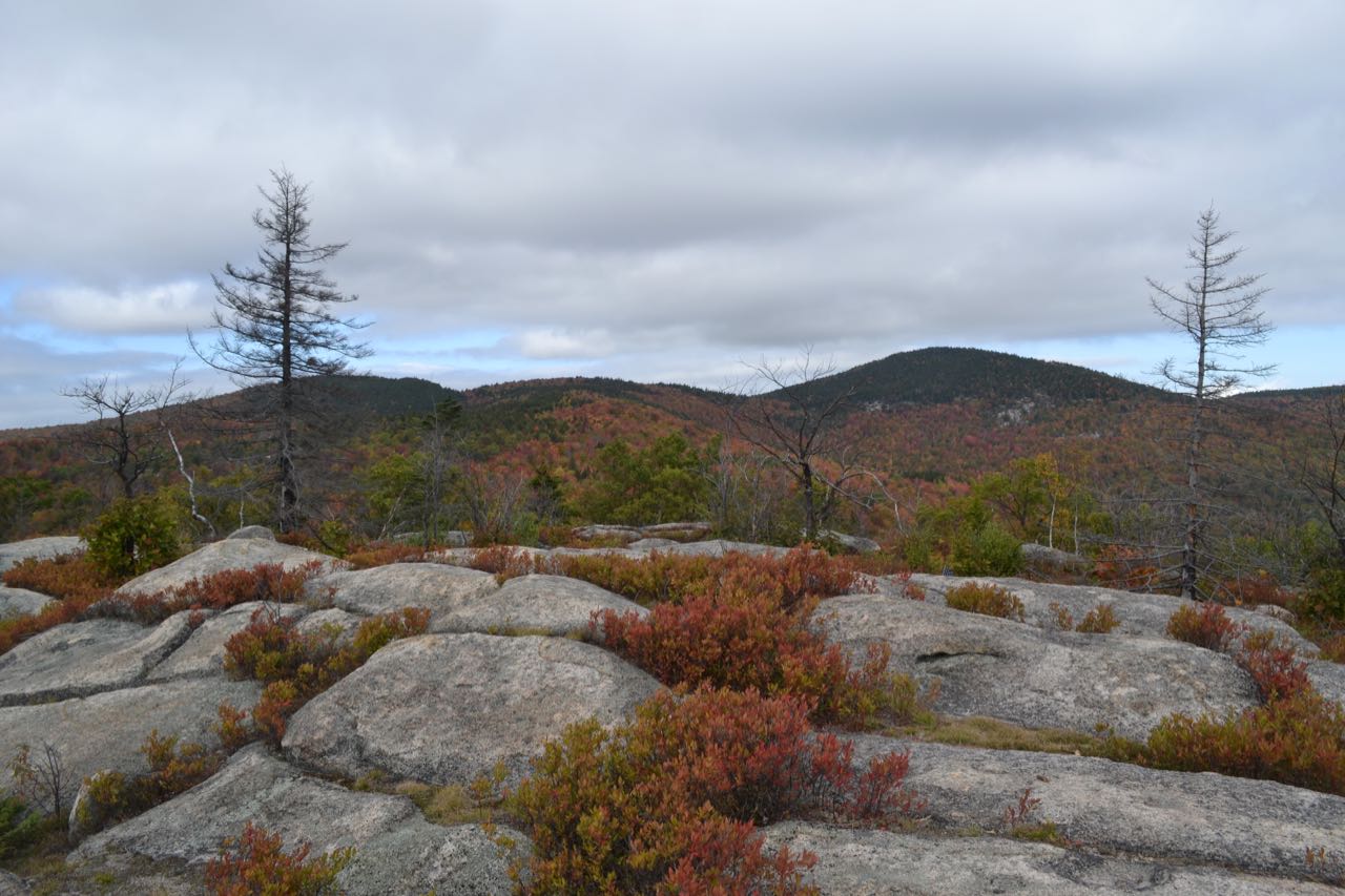
The summit is gorgeous with its windswept ledge and sub-alpine vegetation. You will want to spend some time exploring the area to discover all the different viewpoints. By walking around, you have open views in all directions. If you make it a good distance down the southeastern side of the summit dome, you may find an unusual summit register, in a round container attached to a tree. A full half of the view is taken up by the higher ridges of the Ossipees to the south and the great valley in the center of the range. Directly to your south, the ridge rises from Mt. Flagg to the highest summit in the Ossipees, Mt. Shaw. The gentle, rolling ridge leads across your view, high above, to Faraway Mountain, with its cell tower. The ledges of trailless Bald Mountain, very close by to the west, are an interesting feature. From a couple open locations around the highest point, you can look north to the White Mountains. Only the far eastern peaks are visible, including the Carter Range, the Moat Mountains, the Baldface Range, and Kearsarge North. To the northeast is nearby Grant Peak, with Silver Lake seen around its left side. Off to the right of Grant Peak is the great Ossipee Lake, with Green Mountain behind it. Closer by to the right of Ossipee Lake, you look down on Connor Pond. To the southwest, left of Mt. Flagg, you look over the ridge past Thurley Mountain to the Moose Mountains in the Lakes Region.
Printable directions page